News
Why Monitor our Streams? Because Knowledge Is Power!
By Ron Klauda and Bob Boxwell
(August 2024)
The Cove Point Natural Heritage Trust owns the Hellen Creek Forest & Wildlife Preserve located on both sides of the upper tidal section of the Hellen Creek watershed that includes upstream past the head-of-tide. These upper reaches of Hellen Creek, above the Mill Bridge Road crossing, includes an open area were the stream winds back into the forest. Wood ducks and beavers are part of the wildlife here, and the setting along this expansive watershed area is idyllic.
But how healthy are our streams leading into the creek? Why does it run coffee brown after a downpour? Are invasive aquatic species a problem? Have Northern Snakeheads and Blue Catfish found our creek? What about the invasive phragmites? There were non-native Mute Swans here as recently as 2020. Are they gone for good?
In only makes sense that the Trust should want to know more about the watershed it occupies and wants to protect. A new Five-Year Strategic Plan references this concept and a new, energized Board of Trustees is providing the impetus to support quarterly water testing to document and track changes in the ecological health of the streams that drain into the creek. We must monitor regularly and consistently over the long run to know if our streams are getting better or worse or staying about the same. If the Trust doesn’t monitor (plus lab test, survey, study, and observe), there is but one conclusion to be drawn: “We don’t really know what’s going on.”
The best the Trust can and will do is establish a current baseline, keep monitoring, and document future changes. Monitoring should never be a “Do it once and walk away” effort. Additional years of water monitoring will build a data base that will eventually, within 10 years or so, transform into a time series. Achieving that important but challenging goal is necessary to give us the knowledge needed to determine if our streams are improving or degrading or unchanged, compared to the 2024-2025 baseline.
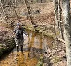
Beyond the basic water chemistry monitoring the Trust waded into this year, we are also considering the addition of a biological component to our monitoring program. Collecting and identifying benthic macroinvertebrates and fish offer an opportunity to ask the critters that live in our streams if their ‘homes’ are healthy or not. We’d also like to know if there are any rare, threatened, endangered, and invasive aquatic animals living in Preserve streams. As the title of this article says, “Knowledge is power”, and the more knowledge we have, the better.
If you would like to receive more information on our specific testing parameters and monitoring results, please write to:
A Hard Rain’s A-Gonna Fall
by Ron Klauda
(26 March 2024)
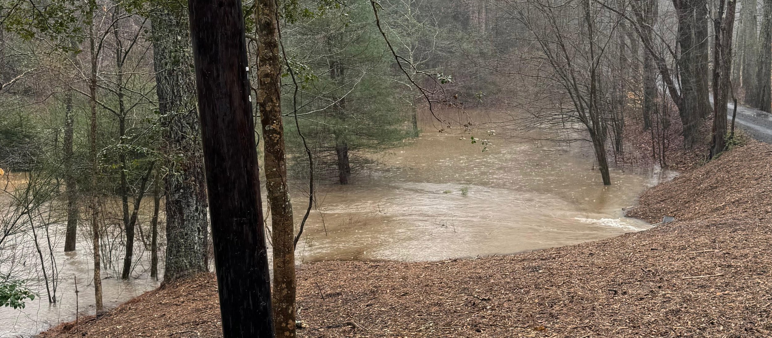
This song by Bob Dylan is an apt description of what the Hellen Creek watershed experienced on March 23 rd . Mike Gardner, President of the Cove Point Nature Heritage Trust, recorded 4.33 inches of rainfall over about 9-1/2 hours at his Tempest One weather station at Preston Point, Lusby MD. Gravity took control of this downpour that fell onto steep slopes of already saturated and highly erodible Calvert County soils. Then, upper Hellen Creek turned into a raging, chocolate brown torrent (see videos).
Non-tidal streams are dynamic systems, so seasonal and storm-associated changes in flow are to be expected. Naturally, along with elevated flows come increases in the downstream transport of sediments---soil erosion from upslope areas plus stream bank and bed erosion.
Human activities can exacerbate natural variations in stream flow and sediment transport. Stormwater runoff and soil erosion from upstream construction sites, urban areas, and places in the landscape where vegetation has been removed can have severe negative impacts on stream biota. High flows can destroy aquatic vegetation, degrade physical habitat, and expose benthic macroinvertebrates and fish to an influx of toxic contaminants washed off the human-altered landscape.
The Friends of Hellen Creek don’t know the severity of the ecological impacts of the caused by the March 23 rd “flood”. For sure, the videos clearly show that a lot of sediment was transported downstream to the tidal creek and on into the Patuxent River….not good news for the Chesapeake Bay’s sediment and nutrient diet. On a more positive note, the beaver ponds on upper Hellen Creek, just downstream from the Old Mill Rd. culvert where the videos were shot, likely intercepted some of the eroded sediments.
Climate scientists tell us that annual rainfall is increasing in Maryland, and more of our rain is now falling as downpours (like the March 23 rd storm), which is increasing the frequency of inland flooding events (like the videos in upper Hellen Creek show). This situation is only expected to worsen by 2050 and beyond. Better stormwater management is one important adaptive strategy that we must embrace to protect the Hellen Creek watershed, the Patuxent River, and the Chesapeake Bay.